Garrett Trails
  • Home
  • About
  • Trails & Maps
    • All Terrain Wheelchair
    • Trails >
      • Water Trails
      • Cunningham Swamp WMA
      • Hoyes Run Fishing Trail & Boat Launch
      • Mosser Road Heritage Trail
      • Swallow Falls Fishermans Trail
    • The ULTIMATE Garrett County Adventure Map
    • Fork Run Recreational Area Orienteering Course
    • Snowmobile and ORV Information
  • Events
    • Garrett County Gran Fondo
    • Taste of Garrett County
  • Gallery
  • Eastern Continental Divide Loop
    • ECDL Overview
  • Get Involved!
    • Donate or Sponsor
    • Comment Card
  • Community Links
  • Volunteer Portal

​Loch Lynn Trail

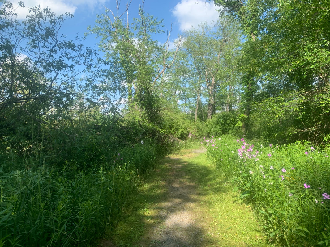
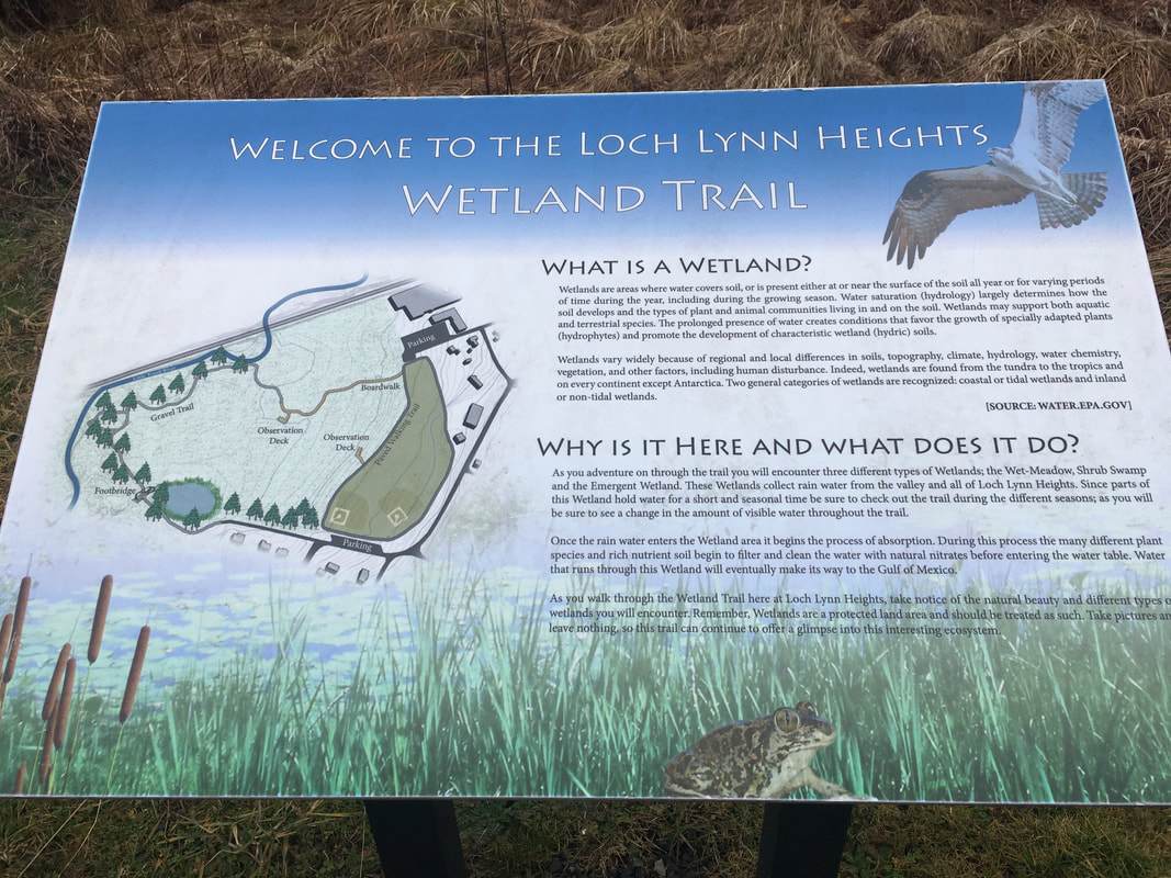
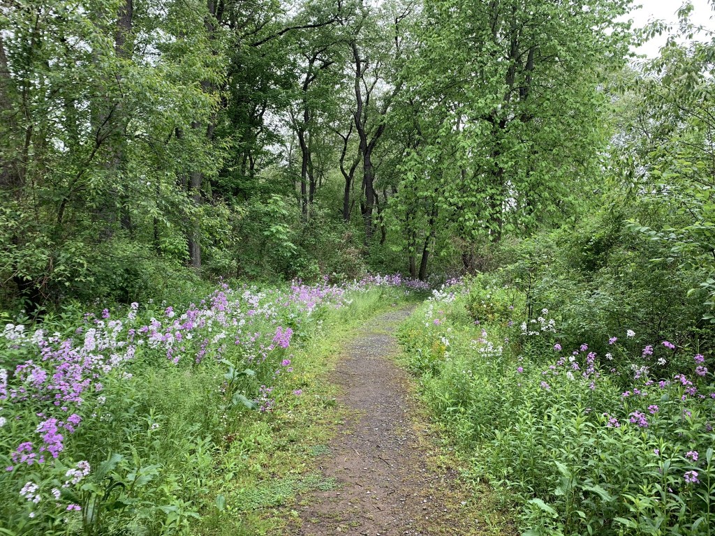
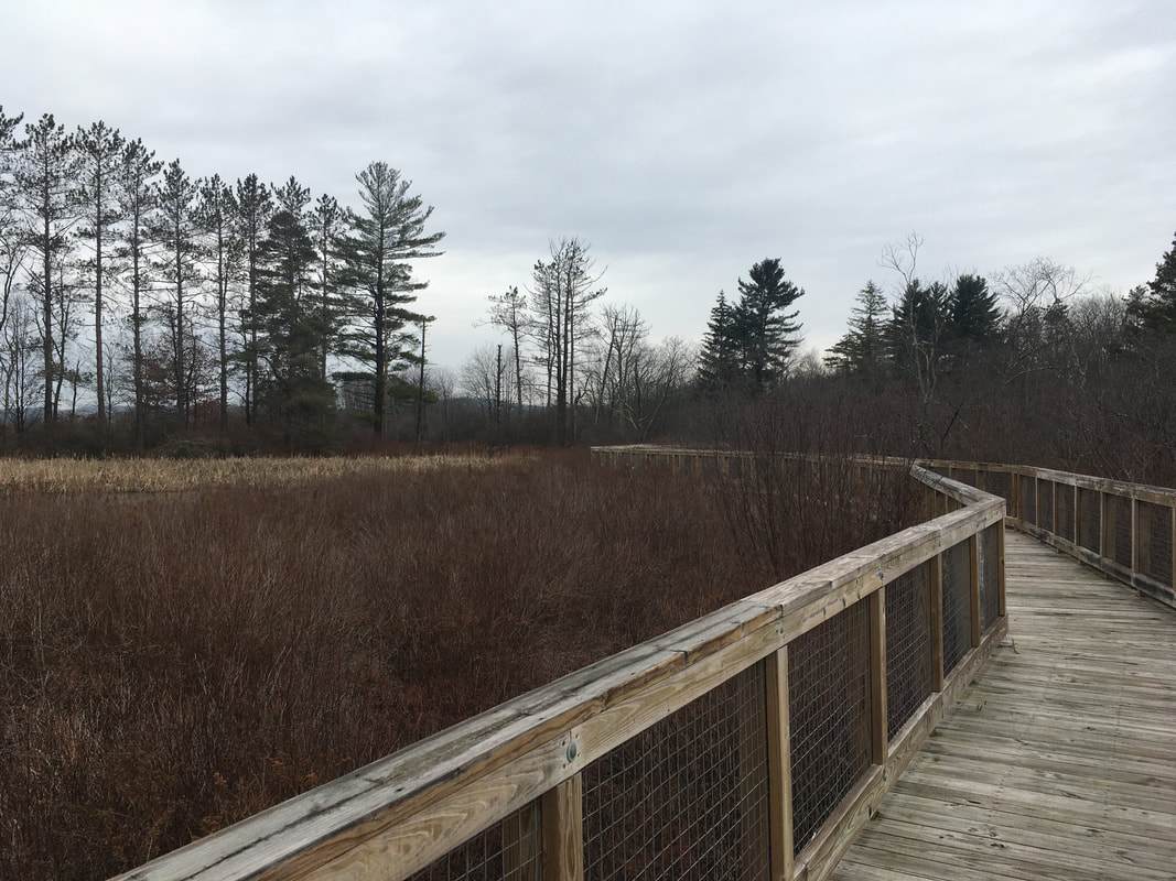
Description: This is a short fitness/walking trail around the town’s athletic fields. The new section of trail provides an elevated boardwalk over a wetland area and gravel trail along the Little Youghiogheny River. 

Use: Walking
Difficulty: Easy
Directions: 22 minutes, 15.1 miles from Visitor Center Drive; Turn right onto RT-219 S 6.5 miles, turn left onto Sand Flat Rd 4.4 miles, turn right onto MD-135 W 3.3 miles, turn left onto Gorman St/RT560 100 feet, turn right onto West 2nd Ave 384 feet. 

Directions to trailhead parking on Google Maps

​© Garrett Trails. All rights reserved.
  • Home
  • About
  • Trails & Maps
    • All Terrain Wheelchair
    • Trails >
      • Water Trails
      • Cunningham Swamp WMA
      • Hoyes Run Fishing Trail & Boat Launch
      • Mosser Road Heritage Trail
      • Swallow Falls Fishermans Trail
    • The ULTIMATE Garrett County Adventure Map
    • Fork Run Recreational Area Orienteering Course
    • Snowmobile and ORV Information
  • Events
    • Garrett County Gran Fondo
    • Taste of Garrett County
  • Gallery
  • Eastern Continental Divide Loop
    • ECDL Overview
  • Get Involved!
    • Donate or Sponsor
    • Comment Card
  • Community Links
  • Volunteer Portal